
Overview
More and more geospatial data is made available through Open Data Portals such as (City of Sacramento or CA GeoPortal). This “open data” can be used in a variety of ways (adding layers to ArcGIS Online (or similar Web GIS platforms), desktop applications (Pro, QGIS, etc), mobile app development (through GeoJSON data feeds), and download (geodatabase, KML, CSV, etc)).
In today’s web-based geospatial environment GIS web developers don’t have to download, process, and then upload data, if it exists via a publicly available platform (such as ArcGIS Online (AGOL)) and the firm or agency has granted “public” access to the data. In the US, many public agencies provide geospatial data through Open Data Portals (many of which happen to use the ESRI ArcGIS Online platform).
A major benefit of directly using Open Data sources is the most current and authoritative data is available at any time and the map creator or web map app developer doesn’t have to maintain the data source over time (unless the authoritative source makes data schema changes…which is unlikely and will be seldom).
Prerequisite
A user must have access to an organizational account to ArcGIS Online to create web map and web map apps. Open Data layer from ArcGIS Online (or directly from an organization’s Open Data Portal can be added to an ArcPro project without an ArcGIS Online account, but they need to have an ArcGIS Online user account to use ArcPro.
Adding Open Data to an ArcGIS Online Map
Adding and configuring Open Data is pretty easy. One has to Search for data, which can be the entire ArcGIS Online presence of publicly available Open Data, limited to a specific organization’s data, or one own’s personal published information to ArcGIS Online (which may not be shared or made publicly available).
Sign in to ArcGIS Online
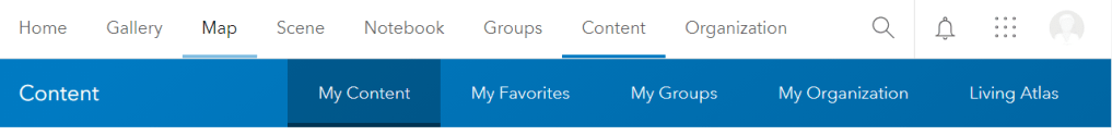
Sign in to ArcGIS Online. Normally, the user will be placed in the Content section of ArcGIS Online. This is where data, maps, or apps are stored and managed by an individual.
Open a New Map
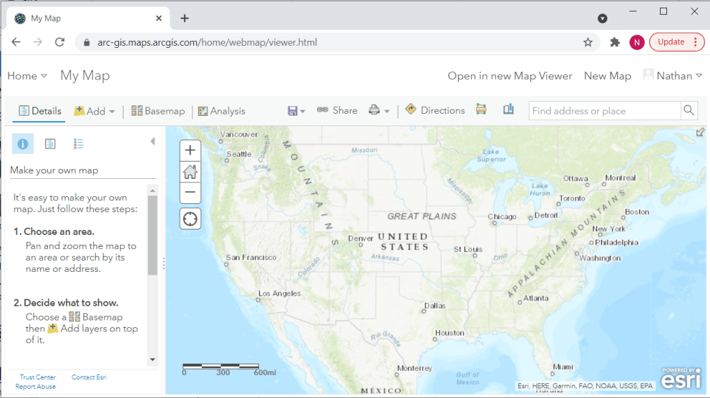
Click the Map link in the header row. This will bring up a blank web map. NOTE: Once a Map is created and saved on AGOL, this saved map can be re-opened and can be further edited and manipulated. An existing Map will can be found in the Content for a specific user or in a Group if the group has been set up and the user has been added as a member and given the appropriate permissions to view and/or edit the map and other map layers.
Depending on how the organization is set up, one of two different map viewers will appear.
Classic Map Viewer
This viewer has been the standard interface to create a web map for several years.
“New” Map Viewer
The “New” Map Viewer is actually the “Map Viewer.” ESRI made this the “official standard viewer” in 2021. Organizations have the ability to choose which viewer is the default viewer. The majority of the documentation shows the “New” Map Viewer interface.

Search for Open Data
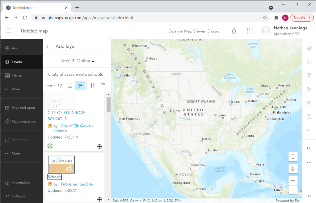
Click Add Layer and change the source from Content to ArcGIS Online. Type in City of Sacramento Schools in the search box just below the words ArcGIS Online (i.e. the source to search) and tap the return key to run the search. Changing the source from Content (i.e. any map layers you create and manage) to ArcGIS Online, the entire Internet is searched where data has been shared to the ESRI cloud where everyone can search and use the map layers. A list of possible GIS layers with either keywords of schools and Sacramento are returned. Notice that many of the possible options seem to have an individual’s name, possibly an ESRI employee reference….these are probably NOT authoritative. The user wants to add “authoritative” map layers to a web map (esp. if this map will be shared to a larger group within an organization or the map or web map app will be shared to the general public. Some layers have a green “authoritative” tag on them. This is a good sign that the map layer is likely a good source…remember, the same layer can be shown multiple times and with an authoritative tag, so one still has to evaluate the source and other information to make sure the layer “is” the one to add to the map. NOTE: The Elk Grove Schools does have the green authoritative tag; the City of Sacramento Schools does not. The City of Sacramento needs to update this tag for the schools layer, but since the user name is the “authoritative name” and the city logo is provided, these are indicators that the layer is authoritative.
Scroll down until the City of Sacramento logo (and the Publisher_SacCity) user name is shown. The Publisher_SacCity name is the public facing “user name” used on the Open Data Portal (the data actually lives in the ESRI Cloud and is referenced to the City of Sacramento’s Open Data Portal – which is part of an organization’s ArcGIS Online platform). As a good practice, users should read the “meta data” about the layer being considered. Click on the Schools (layer name) and more details will appear. Having “good” (e.g. sources are named, current date exists, basic processing is described, etc) metadata is also a good sign that the map layer is authoritative.
Add the Layer to the Map
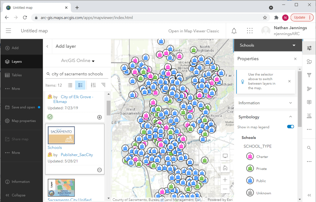
Click the “plus” icon to add the layer to the web map. A default styling already exists from the organization. The user can change this, if desired.
The Properties may appear on the right side. Click the “x” just right of Properties to close this window.
Putting this Altogether
Review this short video showing all of the steps mentioned above.
