
Perform Analysis in Web Map
Spatial Analysis can occur within in the Web Map Viewer where new resultant map layers can be created and then added and configured within Web Map. Keep in mind that these analytical processes can take significant service credits each time the tool is run.
In many cases, the process can be run on localized feature classes where the results are published to ArcGIS Online (or Portal) as a map layer. In the case of ArcGIS Online, service credits are only used for storage for locally processed data (which typically is insignificant for vector data).
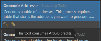
NOTE: Some ArcGIS Pro geoprocessing tools can also consume service credits. Typically, shown with a “gold” symbol.
Geoprocessing Tools in Pro that Consume Credits
The link below summarizes the spatial analysis capabilities within the Web Map environment.
Perform Analysis Tools in Web Map
These tools are grouped into:
- Summarizing Data
- Finding Locations
- Data Enrichment
- Analyze Patterns
- Use Proximity
- Manage Data
- Raster Analysis
Check here for how to Use the Analysis Tools
